
Heart of England Way Association
Route Changes
Any changes made to either HOEW or Arden Way routes, since the publication of the 2012 Guide, will be notified in this section.
If you would like to receive email notifications, please contact us for further details. A small donation is requested for this.
If you would like to volunteer as a section warden, please contact us for further details.
May 2025
Currently no impact from HS2
At Packington Moor - SK 1475 0621
Section 03 - Lichfield to Packington Moor
May 2025
Route Diversion
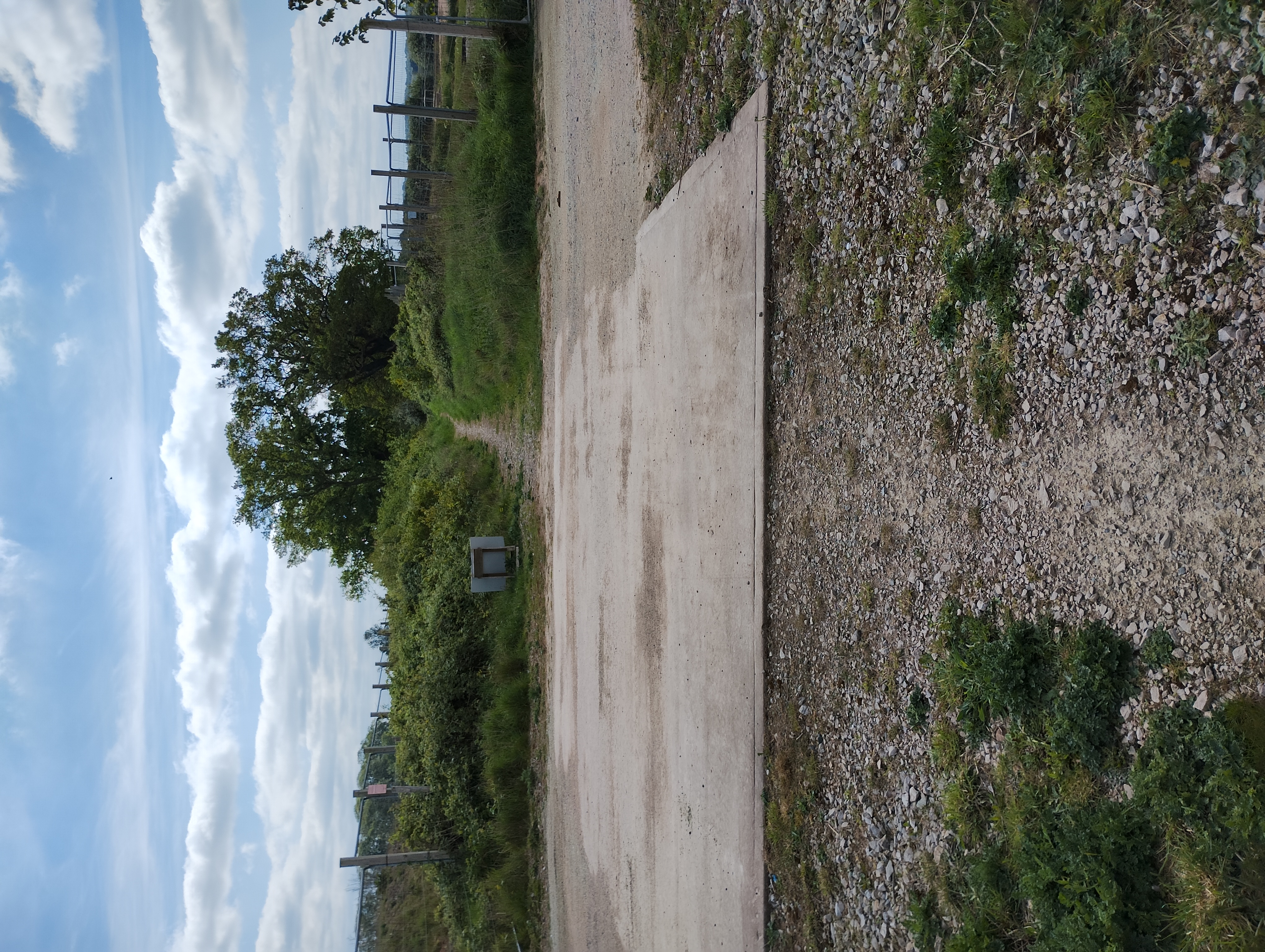
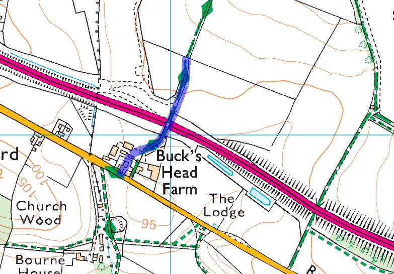
Buck's Head Farm - SK 1491 0393
There is a minor diversion by Buck's Head Farm through the work site for HS2
Read more...
Section 04 - Packington Moor to Drayton Bassett

May 2025
Currently no impact from HS2
At Stone House - SK 1699 0036
Section 04 - Packington Moor to Drayton Bassett
Route Diversion
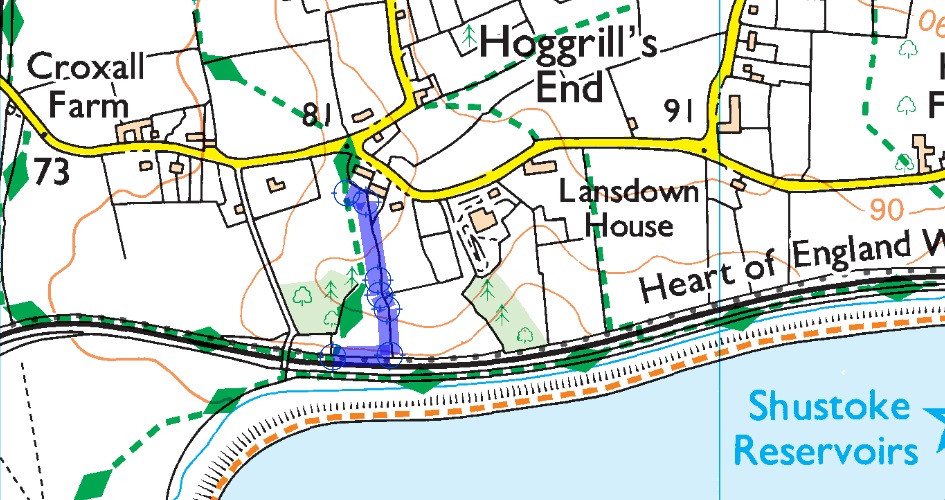
Route change south of Hoggrills End Lane
Starting at grid reference SP 2248 9171
Following hedge row on left hand side of field.
At SP 2254 9148 turning right to follow path beside railway trak.
Finishing at SP 2246 9148
Returning to original route.
Section 7 - Halloughton to Shustoke (B4117)
Jan 2026
Route Alteration
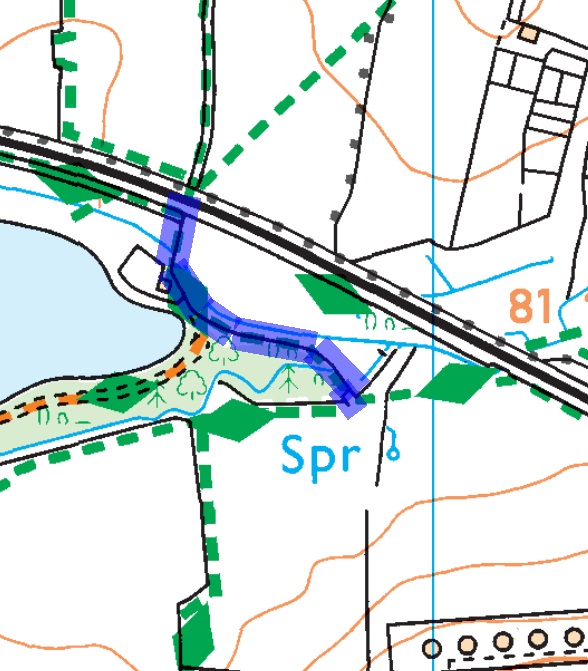
Route alteration east of Shustoke Reservoir
This alteration has been incorporated into the current GPX file.
Section 07 Halloughton to Shustoke (B4117)
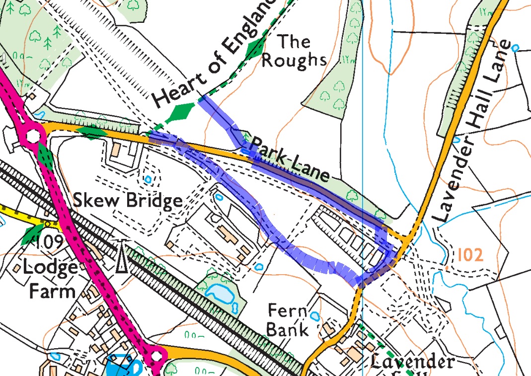
May 2025
Route Diversion
Walking north to south.
Starting at SP 2363 7868
Turn left to follow fence line
At SP 2376 7855 turn right to wards gate leading onto Park Lane
At gate turn left onto Park Lane
Follow Park Lane tuning right onto Public right of way at SP 2405 7836
Cross over crossing at SP 2367 7850
Return to original route at SP 2351 7859
Read more...
Section 11 Meriden to Balsall Common May 2025
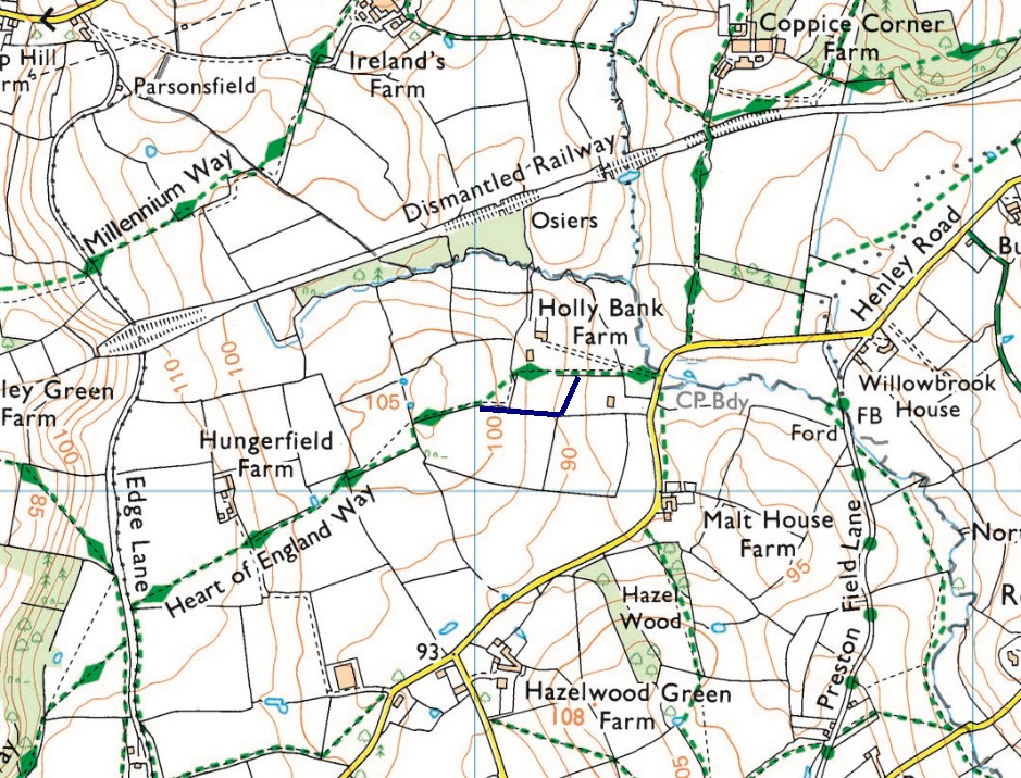
Route Alteration
Starting at SP 1721 6723
to SP 1717 6715
Finish at SP 1701 6716
This alteration has been incorporated into the current GPX file.
Section 14 Lowsonford to Henley in Arden
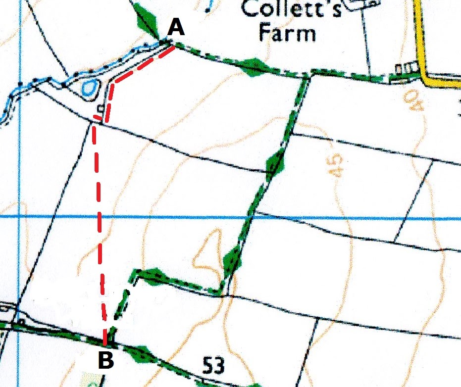
Route Alteration
Rerouting of HoEW at Dorsington to Permissive Path
The Heart of England Way has been re-routed onto a new footpath between points A and B (near Dorsington village) by permission of the Heart of England Forest Charity.
Please follow HOEW signs on red route.
The new route uses an attractive permissive footpath and has been comprehensively signed with marker posts and notices. (the old route used a bridleway that in winter always became very muddy and unpleasant).
Travelling east from point B, follow the track and minor road until your reach Dorsington Road.
Ordnance Survey have been informed of the changes.
When we get authorisation in writing from the Forest Trust agreeing to the permissive path, then Ordnance Survey will be able to reflect this on maps.
This alteration has been incorporated into the current GPX file.
Section 18 - Bidford on Avon to Dorsington
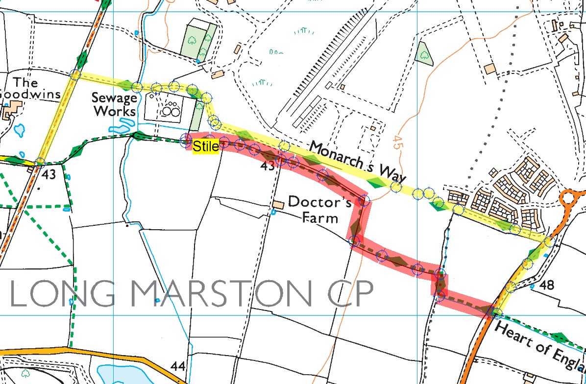
Sept 2025
Route Diversion
Section 19 Dorsington to Lower Quinton
This is due too a damaged unsafe stile at grid ref SP 16241 48583
Read more at Damage stile...
- We would advise walkers leaving the village of Long Marston to follow Wyre Lane to the Railway Cottages.
- Turning left on to The Greenway (Bridle Path)
- After 0.19mls turn right on to new path way following Monarch's Way signage.
- Cross the B4632 at pelican crossing.
- Turning right to follow pavement until you pick up the origin HOE route on you left.
Dated Friday 21/09/2025


